Lemur allows staff to record locations, grade gas leaks and test assets to ensure repair integrity. They can draw digital polygons that get saved in GIS or click a button to send leak coordinates to the office.
Modern mobile mapping improves data accuracy and field mobility for utilities before, during and after events
The rise of extreme weather events in the U.S. and worldwide has impacted service reliability and cost for asset-intensive companies like utilities. In 2023, the United States experienced 28 separate weather or climate disasters, each resulting in at least $1 billion in damages. In California alone, extreme weather accounted for almost 61% of major outages from 2000 to 2023.
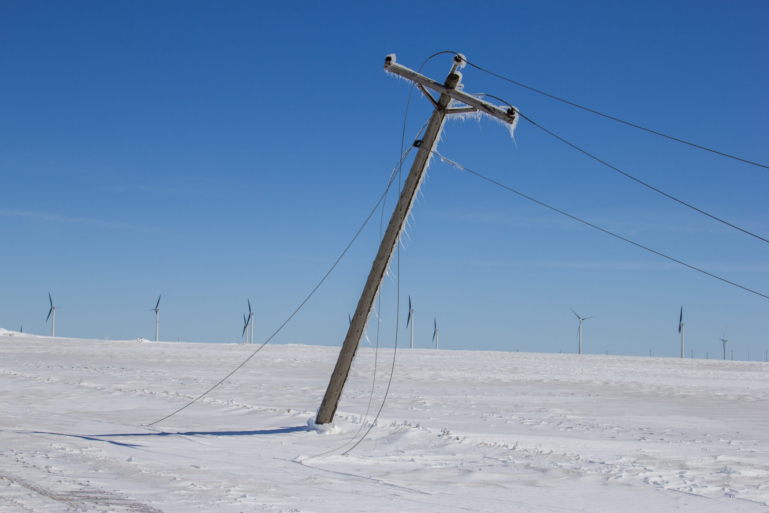
Increased severe weather, including hurricanes, floods, wildfires and snowstorms, threaten heavy damage to utility networks and aging infrastructure. Electric, gas, water and telecommunications alike have an increased risk of service disruption due to outages. And as populations boom and people continue to move to urban centers and adjacent areas that are more vulnerable to disasters, the issue only compounds.
While power companies must grapple with the rise of natural disasters, Lemur’s modern mobile mapping solution supplies robust tools to help utilities prepare for, respond to and recover from extreme weather-related emergencies. Staff can access and update data as they perform duties to ensure high-quality information is immediately available when a disaster strikes. They can operate in the field using mobile devices to view and capture updates for vital information needed for maintenance and repairs, enabling a more effective response.

Extreme Weather Increases Outages
Utilities have a track record of restoring power in the most ardent conditions. Wind, rain, snow, fire—in any environment, staff are trained and expert in operating under harsh conditions. Yet climate change makes many types of extreme weather more frequent or intense. These events put stress on aging energy infrastructure. They are among the leading causes of significant power outages in the U.S. because the nation’s electrical grid wasn’t built for the present-day climate.
A greater emphasis exists today for utility businesses to build resiliency and to improve their response to disasters and extreme weather. There has never been a more urgent need to be prepared to address not only extreme weather but also corporate environmental mandates, increased regulations and evolving customer expectations. Thus, companies continue to invest in preparedness, mitigation and response capabilities, which include IT solutions, modern applications, enterprise IT, planning and equipment.

The Need for Asset Accuracy
While utilities are good at planning and responding to outages–including post-event analysis of what worked, what didn’t and what can be improved–many organizations feel increasing pressure for higher-quality data and smarter applications.
Access to accurate and focused data during disaster response enables more field technicians to operate efficiently and safely under extreme conditions. In addition, modern mobile applications make it easier for field crews to document repairs and changes to damaged assets, which is challenging during disasters.
Field staff, including restoration crews brought in to support utilities, often must quickly respond to an event to get services back up and running. They repair or replace assets and networks, relying on paper maps and manuals, or they may rely on several applications on a mobile device that don’t provide a cohesive picture of the situation, introducing risk and delays. Those mobile apps often struggle to work when internet connection is disrupted, which is common in disaster situations. Updates are frequently not effectively recorded because they only capture service restoration, bringing gas, electricity, water or telecommunications operational again. As a result, the repairs and changes to the network and infrastructure go unrecorded unless a post-event survey is conducted to account for all the changes made to the infrastructure.
Challenges for disaster response include:
- Manual field data entry
- Delayed data updates
- Incomplete data capture
- Redundant processes
- Lack of connectivity
Modern Mobile Mapping with Lemur
Lemur improves many dimensions of field data management that ultimately improve response, including:
Organizations can benefit from better field mobility tools to improve data. Utility companies leverage mobile field applications and access accurate data to harden the grid by undergrounding select lines, replacing poles with more durable materials, and improving vegetation management. During a disaster, field technicians can have a consistent set of tools and relevant data to restore service safely and efficiently, in both online and offline environments.
Lemur allows organizations to operate both proactively and reactively as needed. Operating as an extension of a company’s enterprise GIS, Lemur improves operational safety and efficiency and reduces the risk of errors. Integrating GIS and other enterprise systems and extending them to the field, Lemur gives technicians a consistent, single source of truth for work order and asset information. They can collect data from the field and document work completion accurately and efficiently.
Optimize inspections with pre-populated forms, decreasing the potential human error. Whether performing field surveys or inspecting electric or gas lines, users access GIS layers showing assets, customers, roads, network connectivity and more.
Accurately measure, monitor and track vegetation for improved fuel reduction. Give field staff spatial data such as property location, customer data, network and asset data, and public lands. Rate risk and capture hazards like fallen trees or debris around assets.
Users can view, collect and correct asset information from transmission lines to pump stations to gas mains while performing inspections and repairs before, during and after an event. With a few clicks, they can capture information quickly, no matter the location.
Use work order data, GIS and enterprise asset management to give users a holistic view when performing maintenance and repairs. Easily synchronize updated work order and asset information with the master systems across the enterprise.
Field crews can use Lemur to proactively ensure that assets are up to date on maintenance.
That means less risk for those assets to be damaged, fail or cause an emergency, such as a wildfire.
Mobile mapping allows field crews to use location-based tools to inspect and ensure that the infrastructure polls, towers, wires, transformers and other assets are free of debris and vegetation around them. The accurate data collected in the field aids in better planning. Organizations can model and perform hazard analysis to harden infrastructure and identify:
- Where are critical facilities?
- Where are vulnerable areas?
- What are the mitigation factors?
- What are the available resources?
- Where are priorities?
When disaster strikes, Lemur helps field services staff be ready. Equipped with mobile devices that contain work order, asset, network and map details, they can augment their institutional knowledge with high-quality data.
Map-based data provides accurate visualization and understanding of damage in the field. Connected to the enterprise GIS, field leaders and executives can view and visualize the same response data.
Because Lemur functions both in online and offline environments, field crews can perform work in areas without connectivity and not worry about losing data. It enables staff to do the job and digitally document repairs. Users can view digital maps, assets and infrastructure data without an Internet connection or cellular coverage.
This enables field crews to view location and asset attribute information to conduct repairs effectively. For example, they can precisely identify where jumpers must be installed for electric utilities or systems that must be capped or rerouted for gas or water utilities.
They can record field activities consistent with the corporate enterprise GIS and other systems. When the field application connection is restored, data are automatically synced so that any changes that happened in the field are recorded in the applications.
With Lemur mapping, companies gain:
- Remote capabilities for maintenance and repair
- Increased field efficiency
- Improved safety and compliance
- Optimized data access and synchronization
- Lower costs and streamlined processes
Give your organization the tools to respond to events before they strike. Lemur mobile mapping integrates enterprise apps and data with geospatial tools and technology, delivering a solution that supports building better data and quickly responding to emergencies. Lemur provides a modern approach to field service staff responding to extreme weather events. It improves safety, accuracy and performance while restoring service. It augments institutional knowledge with state-of-the-art data capture, display and update using intuitive maps and location-based services. Users can access multiple systems with a single interface while providing near-real-time results back in the office, yet also work offline when connectivity is severed.
Learn more about how Lemur mobile mapping can help before, during and after a disaster strikes.


